[Past Projects]
Dr. Randy Mitchell and Stuart Davis
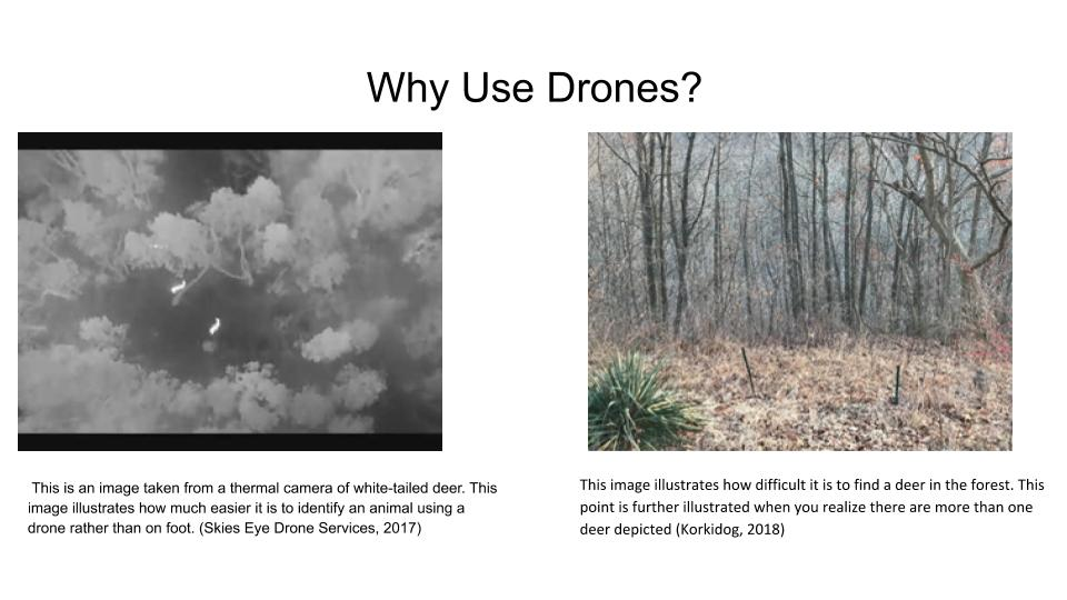
Why Use a Drone?
The main advantages of this method of sampling is that it should be less prone to human error. Instead of a compass, protractor and rangefinder that are required for distance sampling (the method most used), the drone can collect all the necessary data instantly and more reliably. Deer have developed a camouflage that makes it difficult to locate them in some environments. The thermal camera above the tree line with its line of sight not inhibited by trees take away any doubts that a researcher may have in locating and identifying the white-tailed deer. Also, the locations will be georeferenced and digitized and in GIS software any time after the fact. If you are interested in getting more information about this project, email me at spd34@zips.uakron.edu.Click here for more information about the Mitchell lab.